
Lowest, Hottest, Driest
Death Valley National Park is the largest National Park in the continental U.S. at 3.4 million acres. The valley floor lies at 282 feet below sea level and is the lowest point in North America. It holds the record high temperature at 134 degrees F on July 10th, 1913 with summer averages well above 120 degrees F. Located in the Mojave Desert, which is the driest of all U.S. deserts, the area receives less than two inches of rain each year on average. Beyond the iconic images of the old 20 mule team Borax commercials, Death Valley holds surprises of beauty in its rugged terrain, sweeping vistas, and colorful formations.
Visitor Center
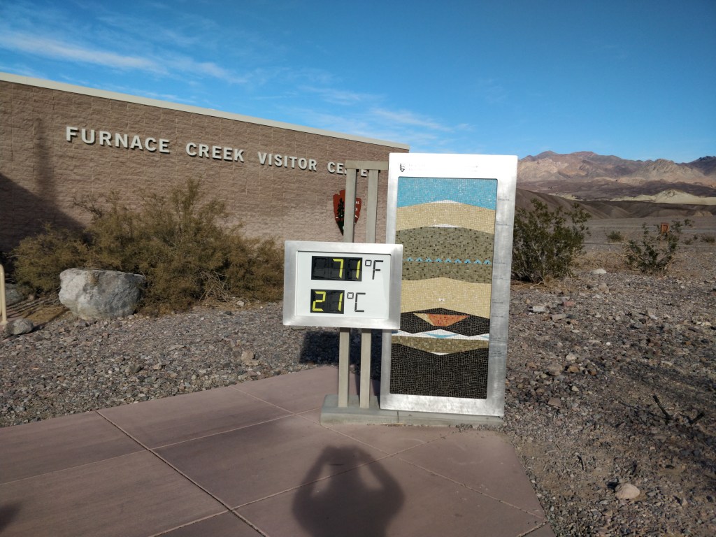
The Visitor Center located at Furnace Creek is a must for excellent information on park activities. Park Rangers staff the information desk and provide maps and directions to make the most of every visit. The daily Ranger Talks and Hikes schedule is posted inside and other announcements can be found on the bulletin boards posted at the exterior of the building near the large current temperature display. Natural History exhibits of the wildlife, plants, geologic and historic features are on display inside the center as well. The gift shop has excellent area maps and books for sale plus beverages, snacks and souvenirs. Only a few picnic tables and benches are located around the exterior of the building.
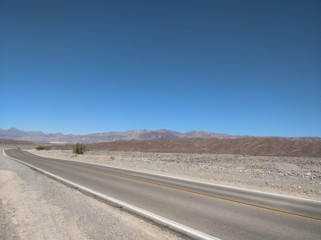
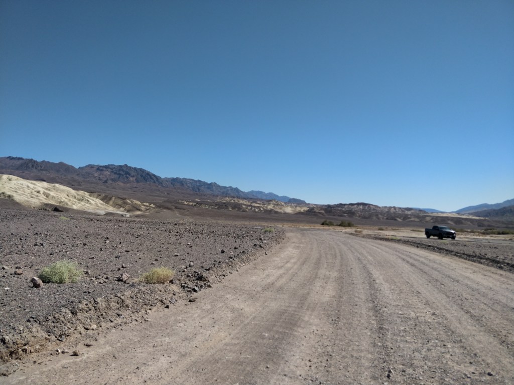
Death Valley National Park contains paved and unpaved roads. It is easily explored by car to the major sites but a high clearance vehicle is recommended for the more remote sections. Fortunately, this is clearly marked on the map provided by the Park along with suggested routes and stops depending on the length of stay. During our visits, many of the roads remained closed for repair following the devastating monsoon rains during August.
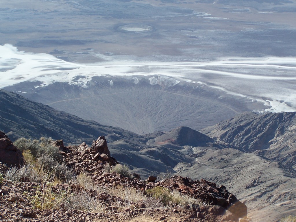
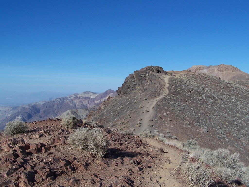
Dantes View
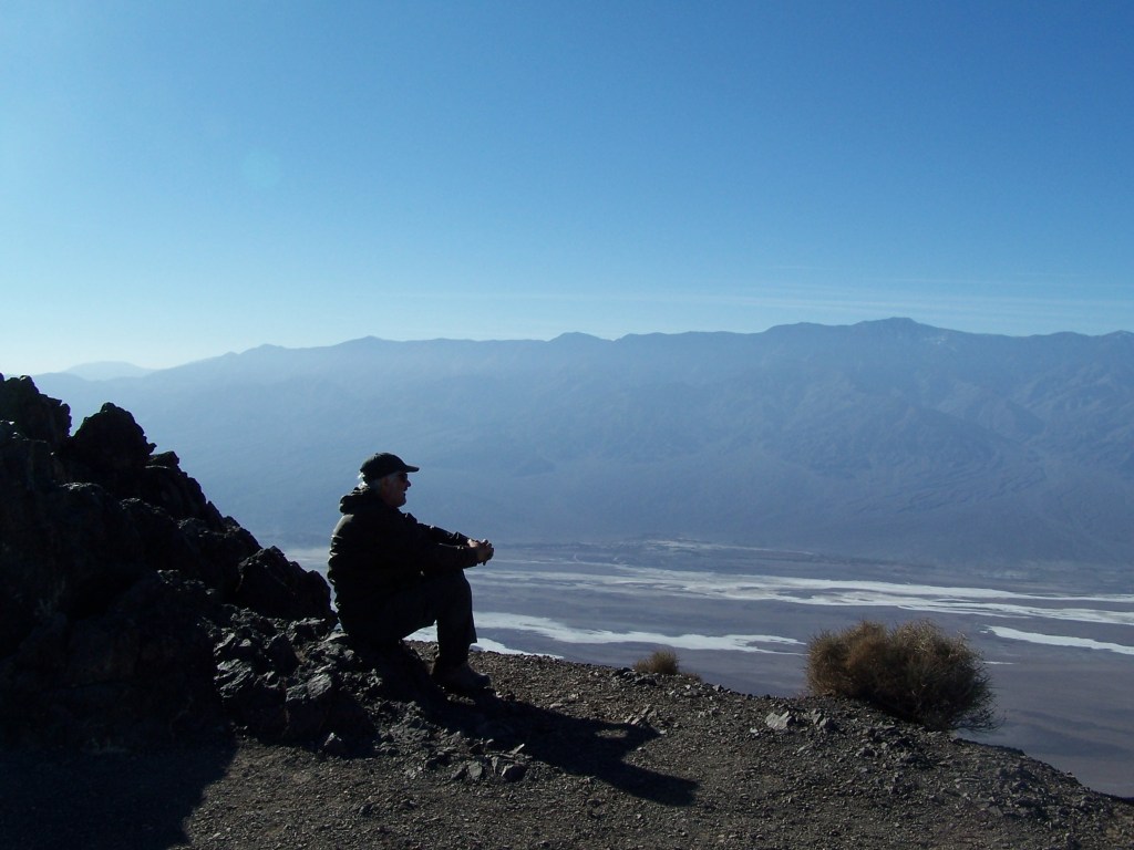
From 5,400 feet, the ridge trail along Dantes View offers sweeping vistas of the valley and surrounding mountains. Far below on the evaporated surface of Death Valley’s last lake, the white salt flats and fault lines stretch to the north for miles. The view gave us a greater understanding of the vast expanse of this national park.

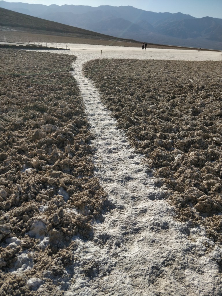
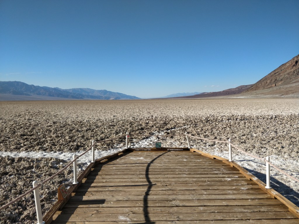
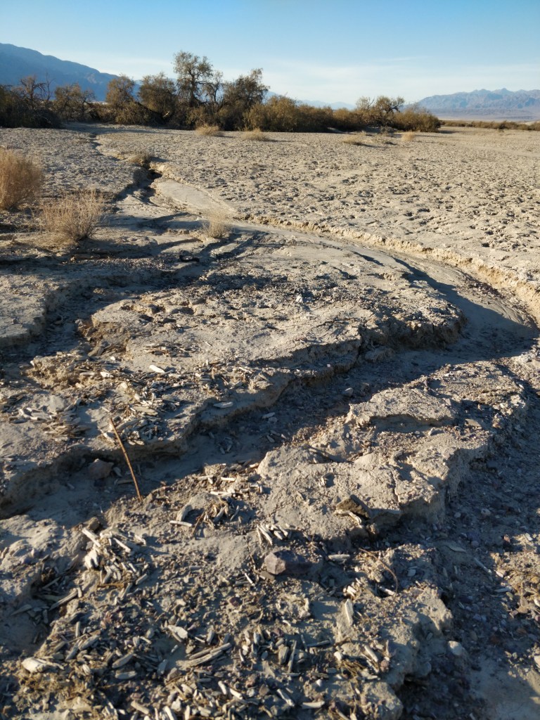
Badwater Basin
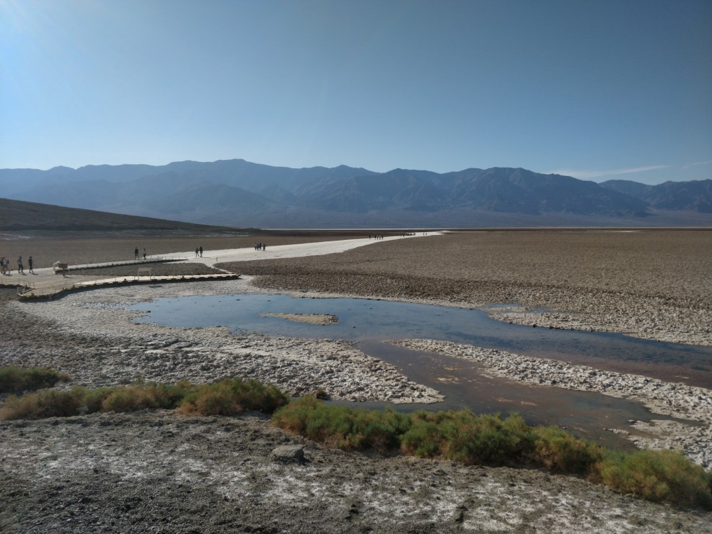
At 282 feet below sea level, Badwater Basin is the lowest point in North America. The basin is what remains of an evaporated lake that left a layer of almost pure table salt. Walking out on the cracked and crunchy white surface, we felt the intensity of the sun radiating off the ground. Looking back at the wall of rock from the basin floor, we could see, far above us, a sign marking sea level.
(The Park’s “Sea Level” sign is barely visible in this picture. It is located just to the right of our picture label.)
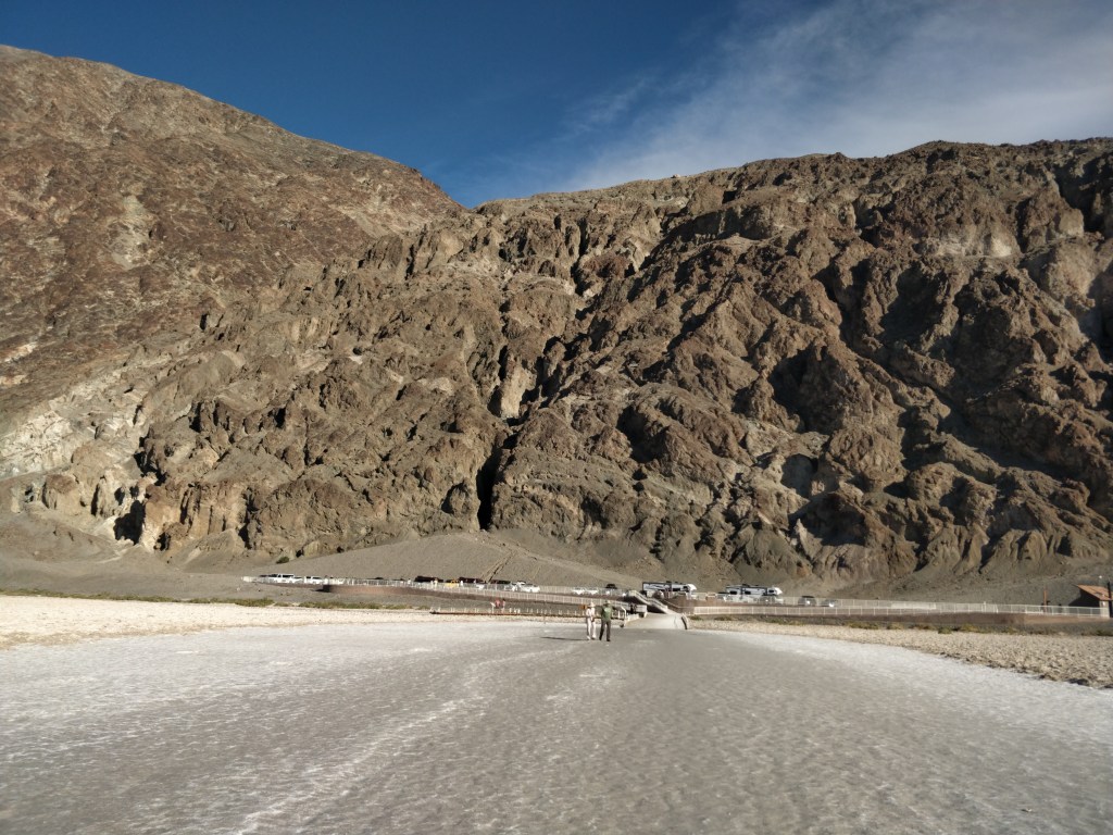
sea level—>
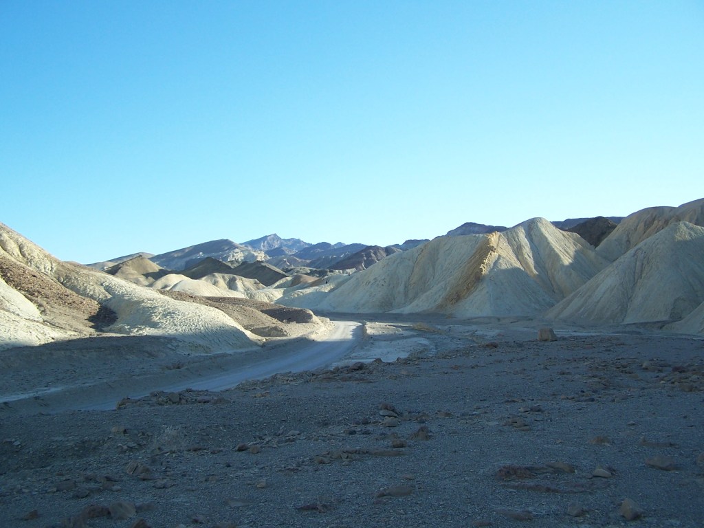
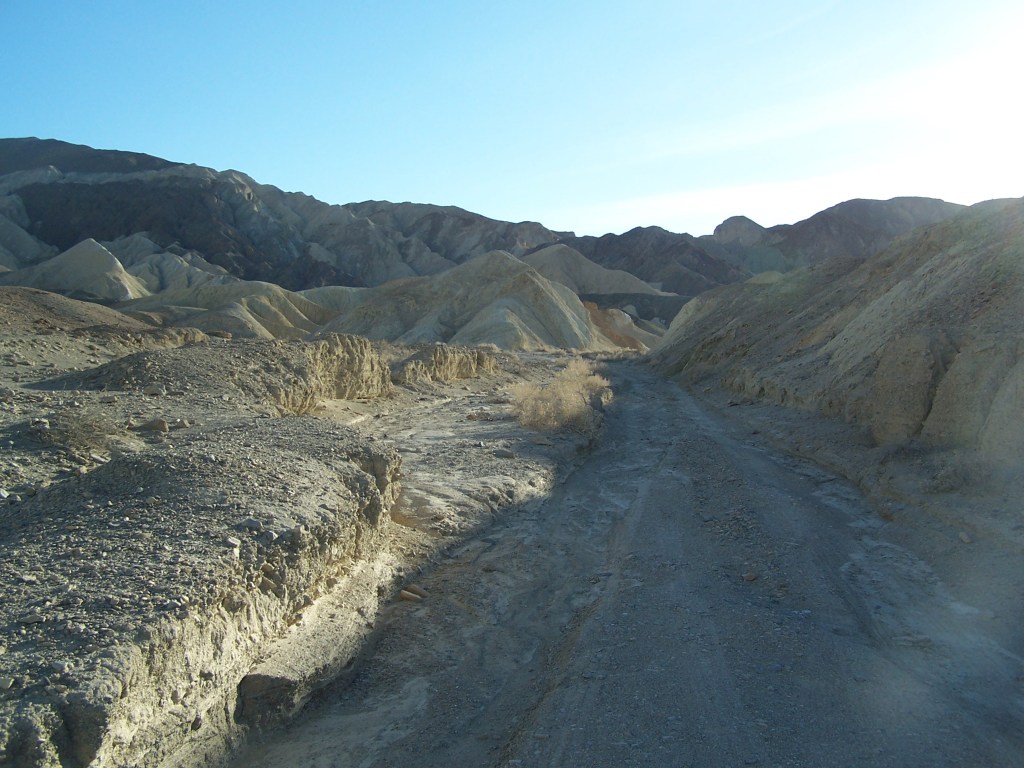
20 Mule Team Canyon
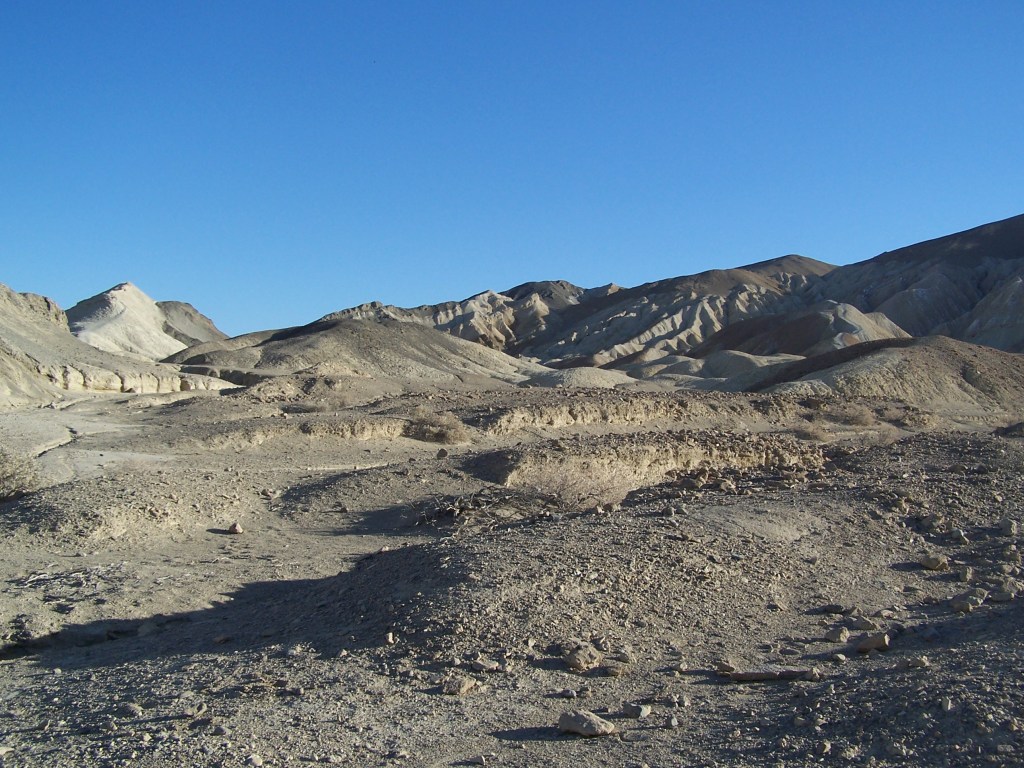
From Badwater Basin and Dantes View, we travel north to a one way dirt road loop into the 20 Mule Team Canyon. Twisting through light yellow hills of eroding badlands, we follow the path that the famous mule teams hauled wagons of borax ore from the Harmony Borax Works at the center of Death Valley. More recently, this area has been used in several movies, including Star Wars!
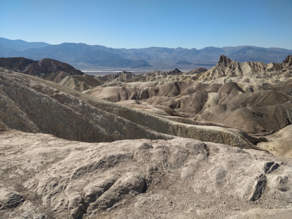
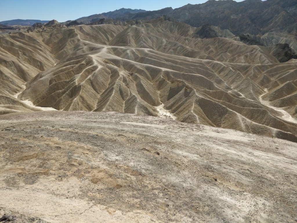
Zabriskie Point

Another panoramic scenic lookout in the southern section of the park and one of the most popular. It came highly recommended by the park rangers. The view of the eroded and striated badlands was reminiscent of the Painted Desert and another facet of stark beauty to be found in Death Valley.
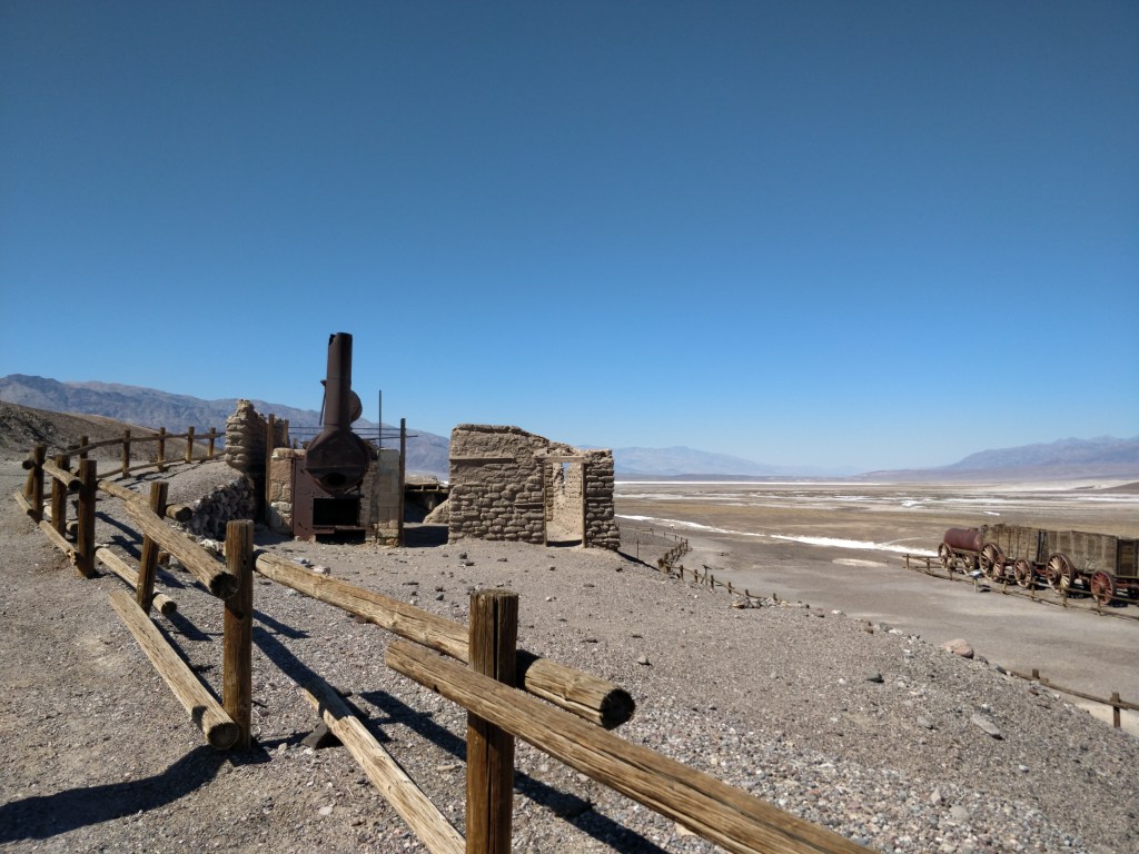
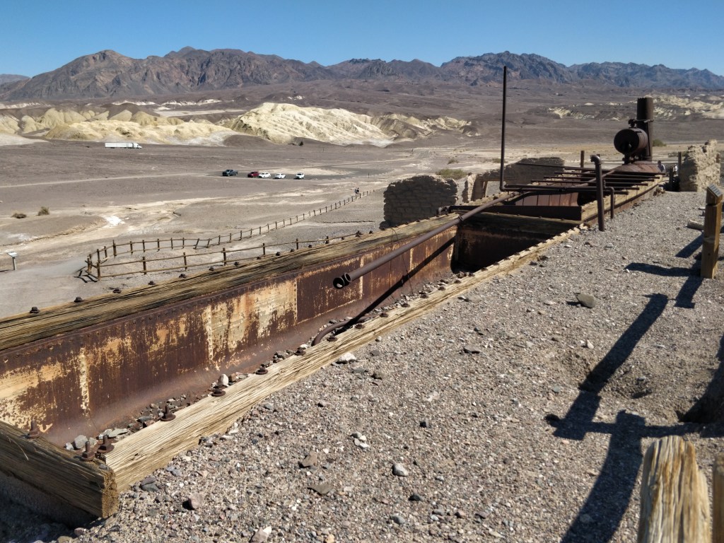
Harmony Borax Works

Remains from a borax mining operation have been preserved on the site where the Harmony plant operated in the 1880’s. The borate ore looked like cotton balls laying on the surface of the salt pan playa. Evaporation and crystallization were used to refine the ore into borax. When running at capacity, the mine employed 40 men to produce three tons of borax daily! The famous 20-mule teams were used to haul borax to the railroad located 160 miles away. Averaging about two miles an hour, it took 30 days to complete a round trip. After five years, the plant closed due to financial setbacks, lack of transportation, and the harsh conditions of the valley.
Devil’s Cornfield

Imaginative names in and around the park allude to the harsh conditions that challenged pioneers, prospectors and developers. Resembling stacked sheaths of corn, Arrowweed plants grow in tall clumps in a barren field. Inedible, the woody stalks of this plant were used by Native Americans as arrow shafts.
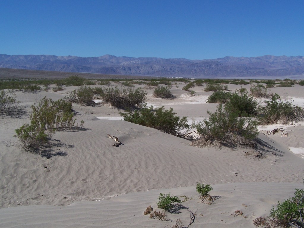
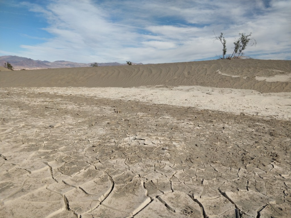
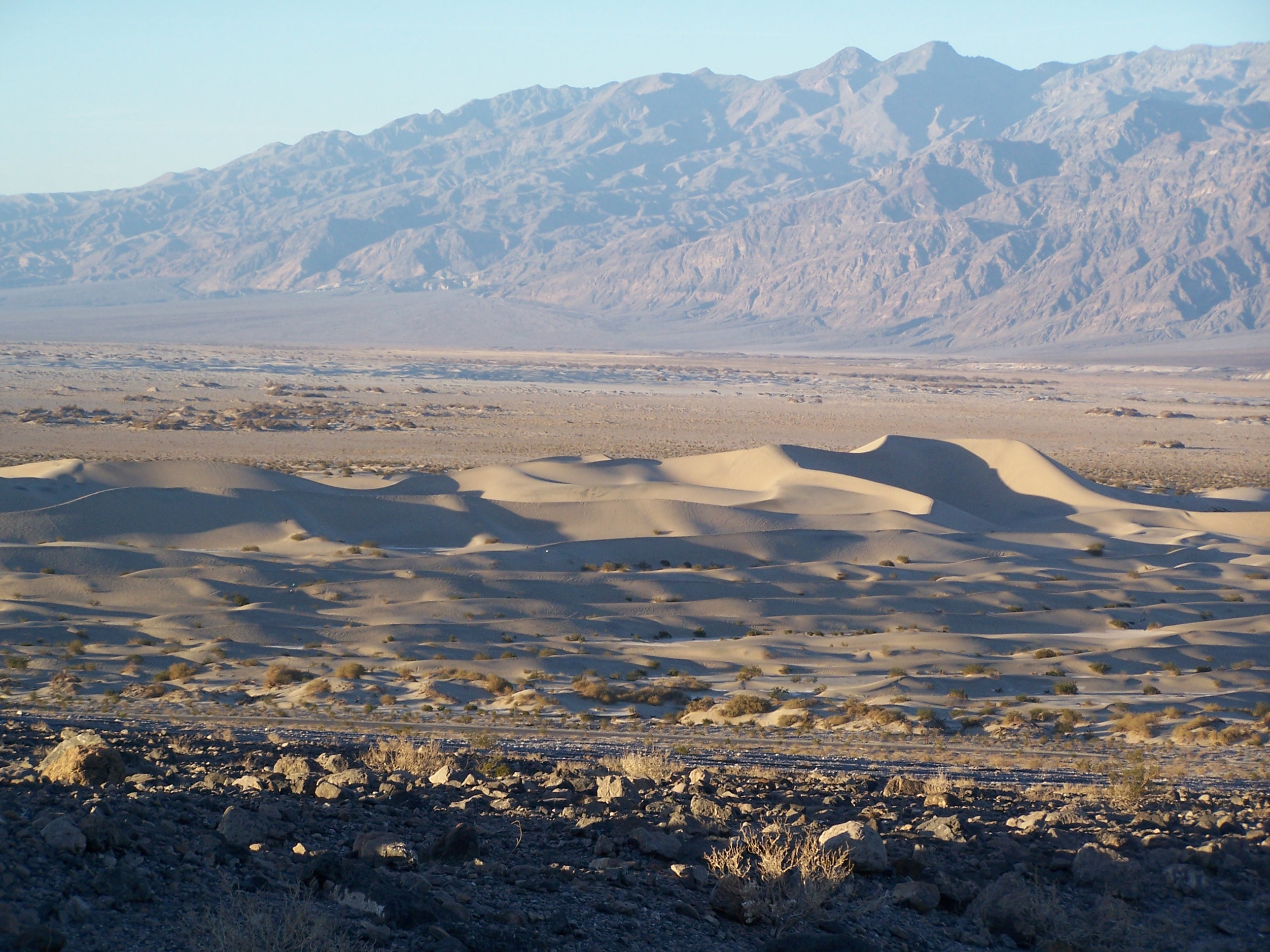
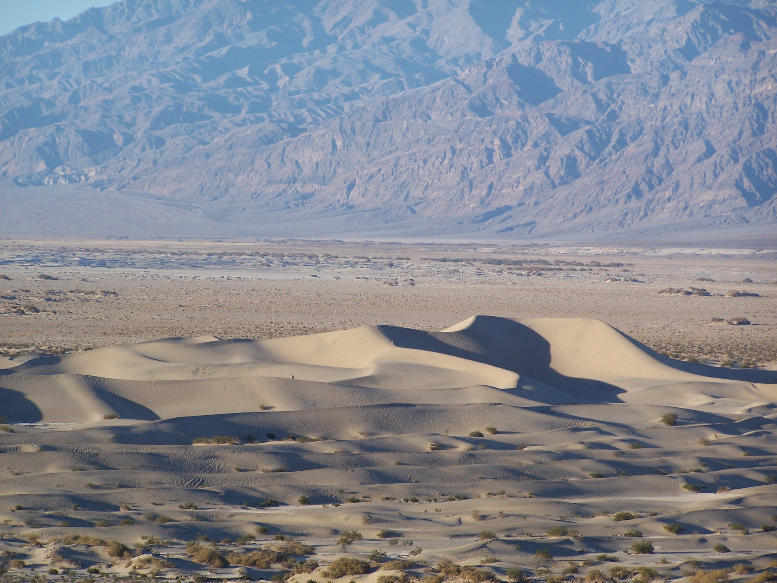
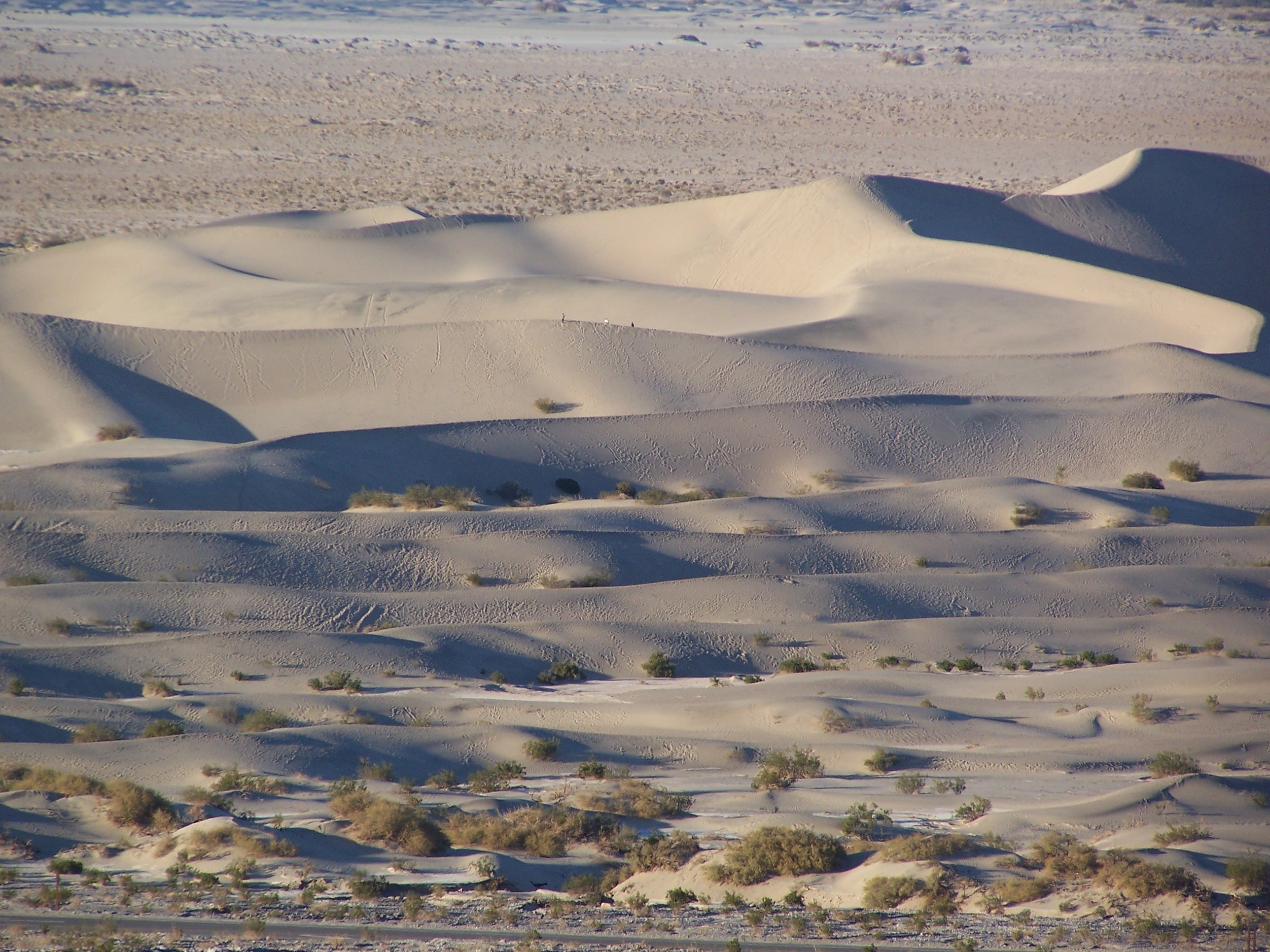
Mesquite Flat Dunes

Located in the center of the park, the 150 ft. tall sand dunes are surrounded by mountains. Wandering is encouraged here as there are no formal trails to follow. Small animal and reptile tracks lead up and around the rippled surfaces hinting at what must be a nocturnal playground. We watched the spectacular effects of shadow and light upon the dunes at sunset from an incline across the road near Grotto Canyon.

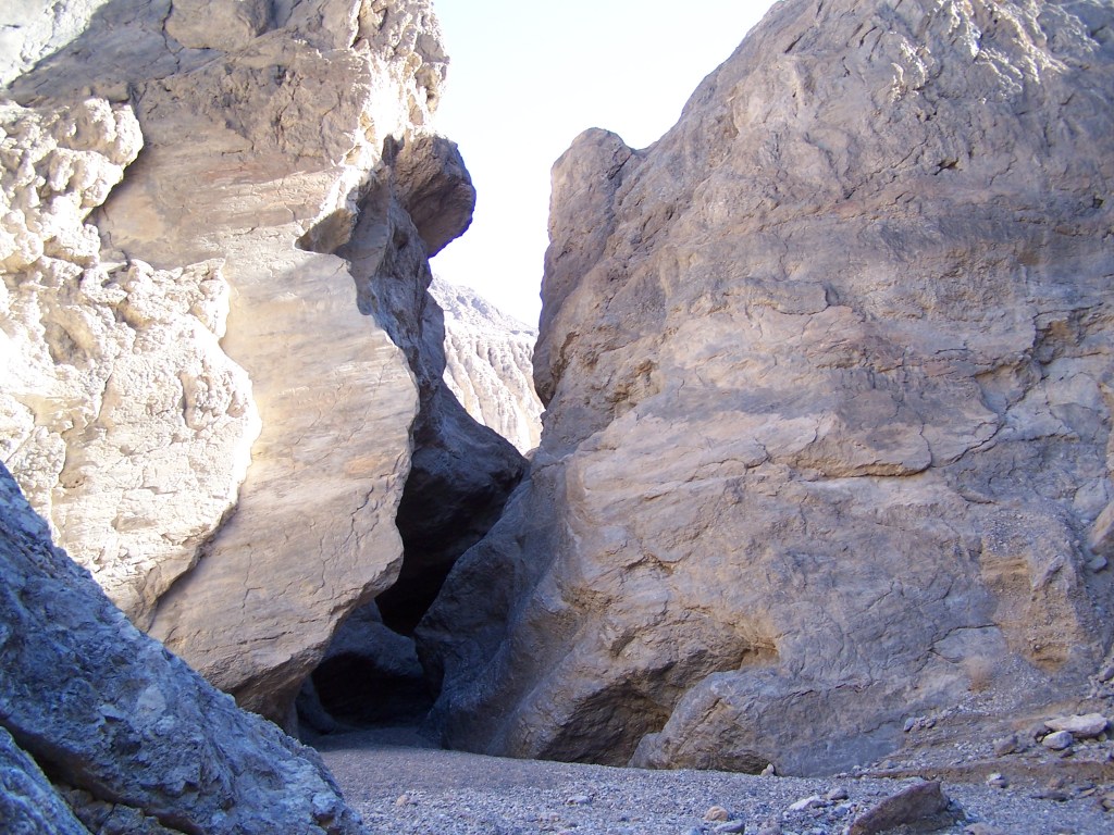
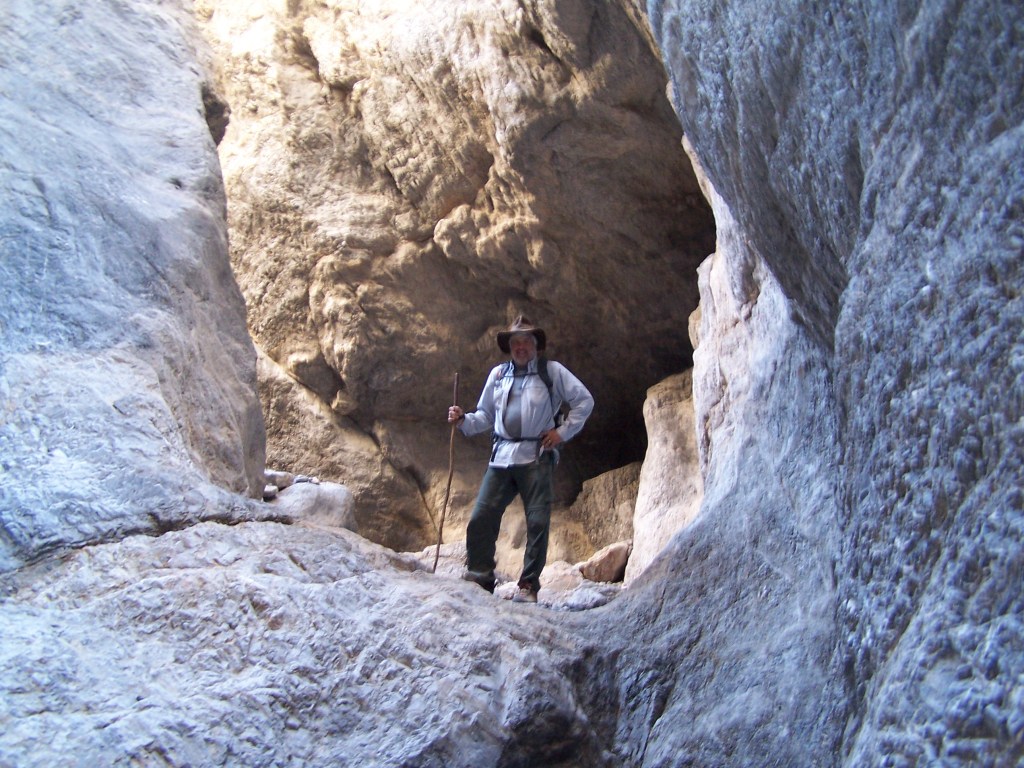
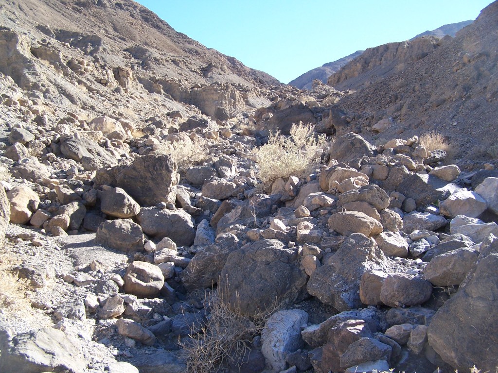
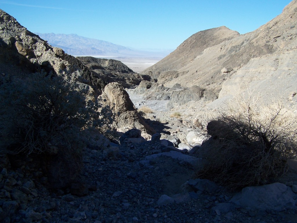
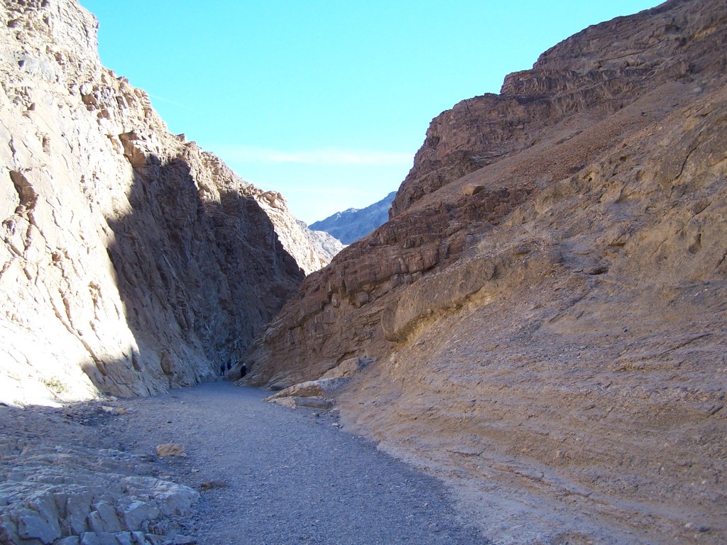
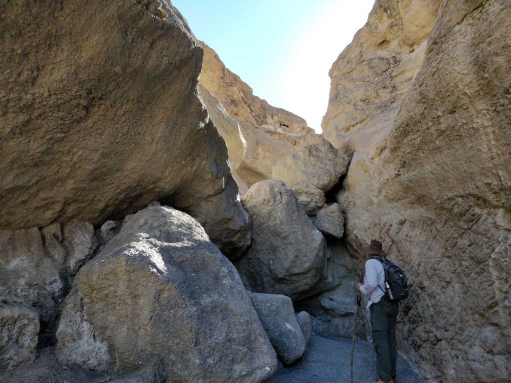
Grotto Canyon
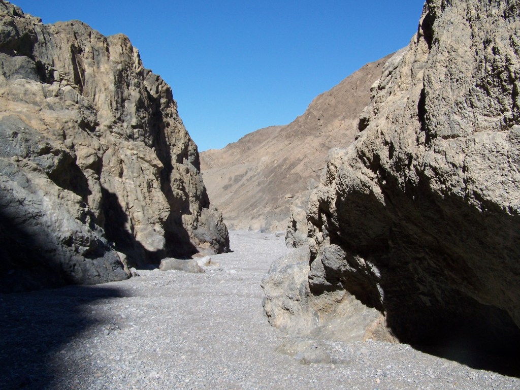
One of the less popular canyons in the Tucki Mountains, Grotto Canyon is wide with a gravel bed leading to narrows and two dry waterfalls. Scrambling around the boulders and squeezing between the rock walls, we managed to get to the top of the first dry falls for an amazing view of the mountains surrounding us. It was so quiet as we explored this part of the desert in solitude.

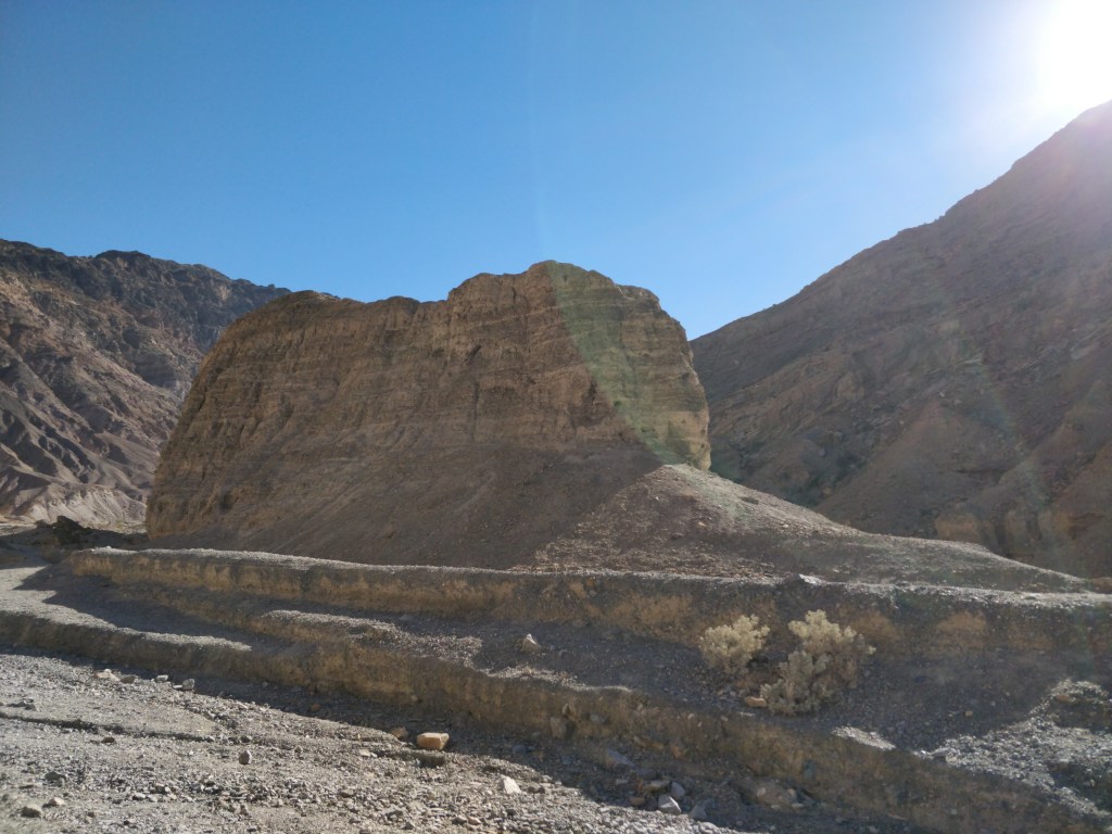
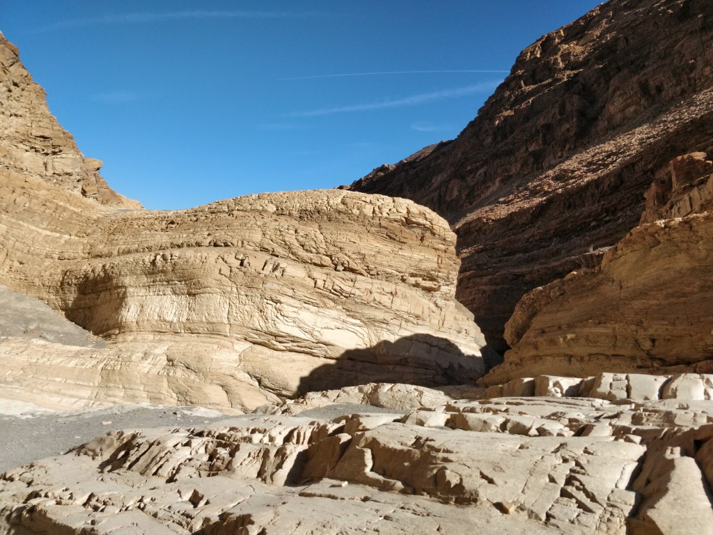
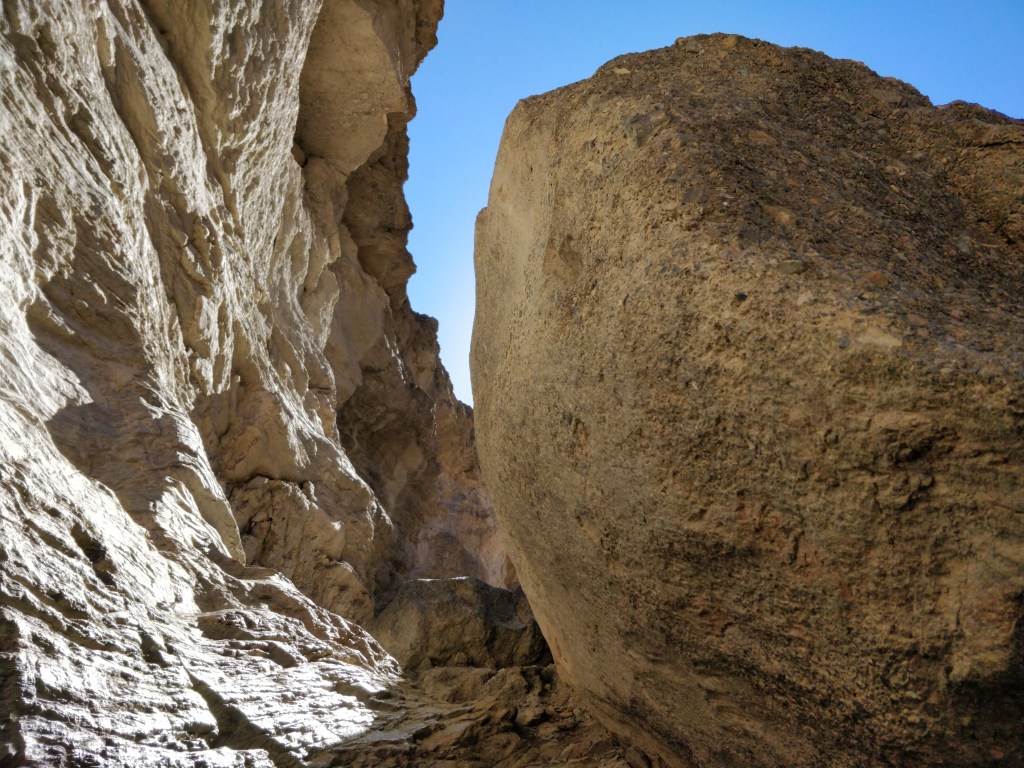
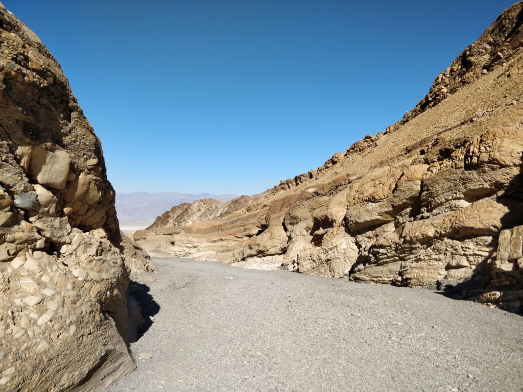
Mosaic Canyon
One of the most popular hikes in Death Valley is into Mosaic Canyon. This was a breathtaking hike (in more ways than one). The dramatic entrance follows narrowing walls worn smooth from the rushing water draining the nearby Tucki Mountains during rainstorms. The canyon widens into a large area called the “amphitheater” where the deep gravel floor winds around buttes, rock formations, and boulders. Continuing on, the canyon narrows again until it reaches a 40 ft. high dry falls. Other pathways lead up and around this obstruction for a more agile hiker. On the return trip, the views from this geologic wonder were just as stunning as the canyon spills out onto the flat desert.


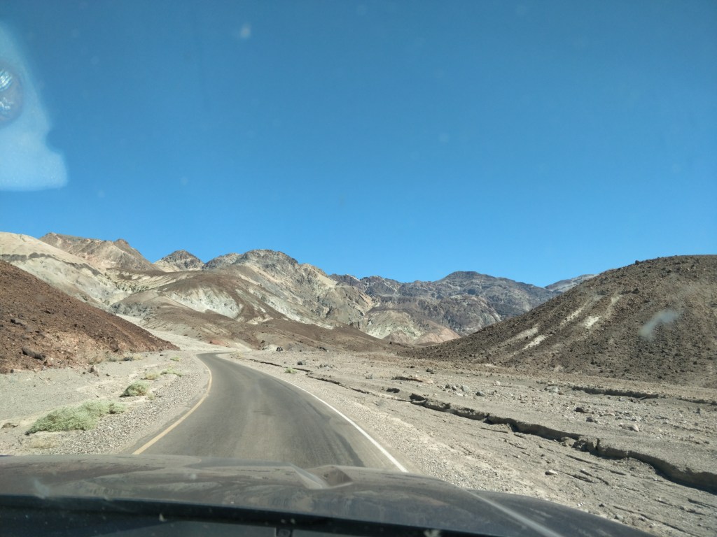
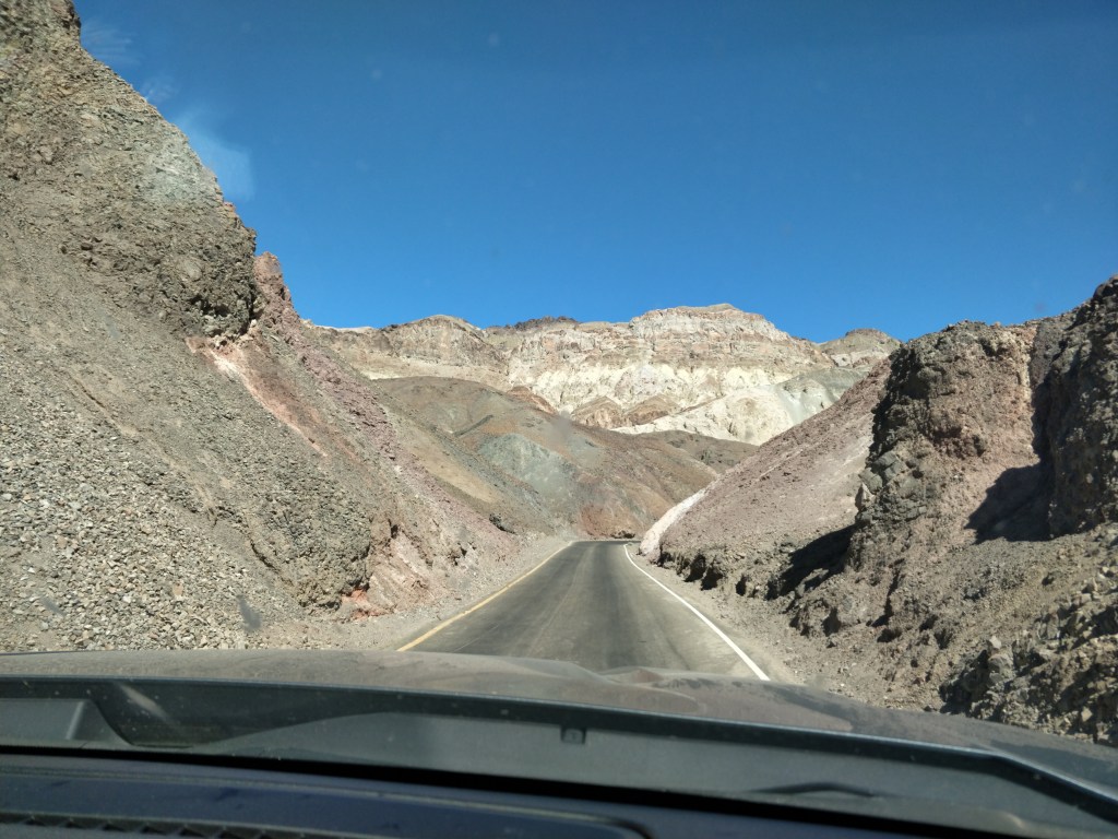
Artists Drive
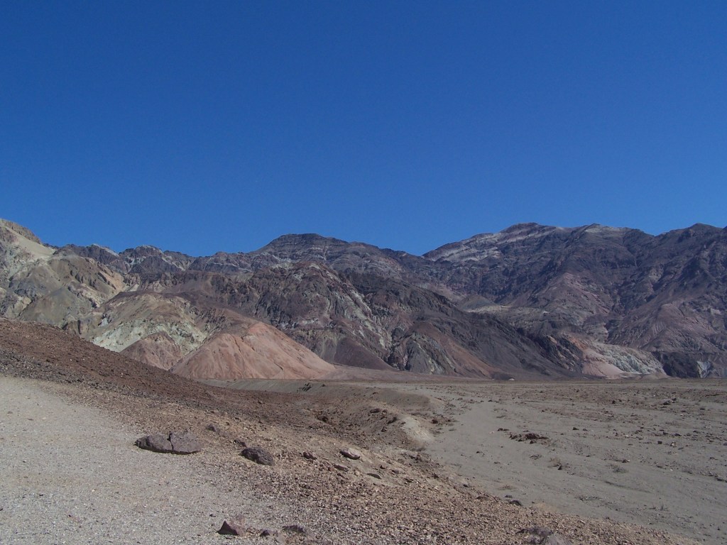
Looping around and heading south back towards Badwater Basin, we took the scenic Artist’s Pallet Drive. This nine mile one way road leads into the remnants of one of Death Valley’s volcanic periods. Rock formations, washes and hills are colored from mineral deposits in pale green, yellow, periwinkle blue, pink and rose. The winding roller-coaster road provides dramatic views around each corner and over each hill.
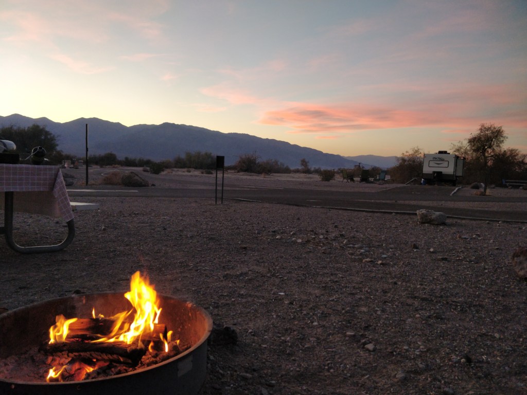
Furnace Creek Campground

Camping in Death Valley allowed us to experience the beauty of the desert sunsets and the night sky filled with stars. Jupiter, Mars and the Milky Way were brightly visible along with Orion and the Pleiades during our stay.
Death Valley National Park holds endless delights and surprises. The design of the park accommodates visits in the extreme heat of the summer as well as in the milder temperate days of winter. We can’t wait to return to explore, hike and observe more wonders of this national treasure.
CAMPGROUND REVIEW: FURNACE CREEK CAMPGROUND
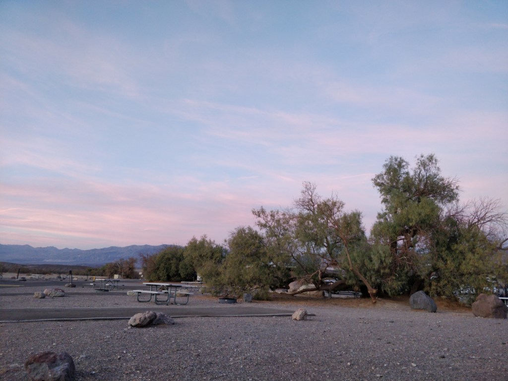
The only campground in Death Valley National Park that accepts reservations is Furnace Creek. We stayed in a dry camping site with a long asphalt back-in drive. The site contained a picnic table and a fire ring with a grate. Some sites have shade trees but most are in full sun. Restrooms with running water and flush toilets were clean and well maintained. Potable water was available in the campground at several outdoor dish washing stations. The Visitor Center is nearby with a paved walkway/cycle path connecting the two. We arrived when the office was closed for lunch but were able to proceed to our reserved site and check in when they re-opened. When we stayed, the campground was somewhat noisier than expected between generators, OHVs, barking dogs and music from nearby RVs. However, the beautiful sunsets, clear and bright night skies, and central location gave us a great desert camping experience.
Thank you for visiting TheirRVtravels! We’re so glad to have you along for the ride!
Please take a moment to subscribe and you’ll receive a notice each time a new post is published.


Next up…Desert Hikes and Deserted Towns
