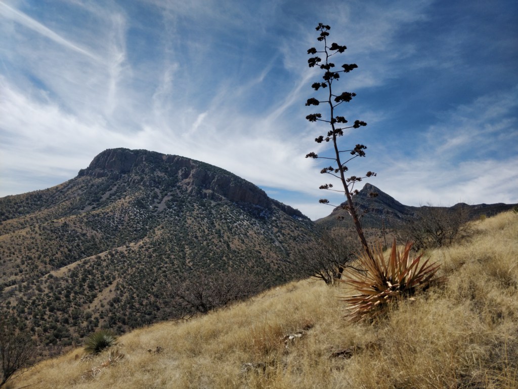
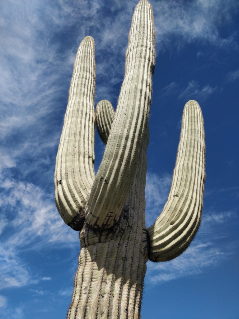
Yuma to Tombstone sounds like it should be a western movie about a stagecoach route. As we traveled between the two cities, it often felt like we were seeing the remnants of the wild wild west. The landscape is filled with Saguaro cactus and numerous desert plants making the Sonoran desert much more lush than the Mojave.
Quartzsite, AZ
Our first boondocking experience on BLM land occurred just outside of Quartzsite. We enjoyed the wide open camping spaces and the beautiful open sky sunsets! However, on our second day, we encountered a gale force desert windstorm which kept shaking and rattling Lil’ Sebastian until we thought we were going to wake up in Oz. Dust filled the sky and reduced visibility dramatically. The sunset was shrouded in orange that evening. Fortunately, these storms move quickly through the area, and our travel south to Yuma was in better conditions.
Yuma, AZ
Yuma is located in the very southwestern corner of Arizona just across the borders of Mexico and California. It has a very active military air base and we watched fighter jets and helicopters fly overhead each day. Yuma is surrounded by a huge area of agricultural farmland. We saw strawberries being harvested by hand and tractors working other fields every day. In the middle of one of the fields adjacent to the main highway was a tiny, tiny church. A sign at the road invited all passersby to Stop, Rest, and Pray. This was the first of three very different and unique churches we visited in Arizona. As a result of the large agricultural community, the Farmers’ Market on Saturdays had an abundant variety of local produce and foods. Tamales, pasta, smoothies, coffee, jerky, salsas and jars of pickled anything were sold in addition to boxes of fruits and vegetables. So delicious!
(click the photo to watch the video)
The Imperials
Bordering the military proving grounds are the beautiful Imperial National Wildlife Refuge and the popular boondocking Imperial Dam BLM lands. Thanks to the knowledgeable volunteer ranger at the wildlife refuge visitor center, we were able to explore several trails and mule paths into the more remote areas. Temperatures at night were hovering around freezing which surprised even the camp host at the Imperial Dam who had been snowbirding there for over 38 years.
(click the photo to watch the video)
Casa Grande, AZ
Along our route to Tombstone, we visited the ancient ruins of Casa Grande. The largest remaining building from the ancient Sonoran desert tribes, this structure was one of the first sites in the nation to be designated as an archaeological reserve. Weathering and vandalism has taken its toll, but the structure is still impressive. Circular openings mark specific solar and lunar events which would have been important to the ancient farming settlements. The excavations surrounding the central structure reveal smaller buildings and common areas as well as a ballcourt similar to the Aztec pits. Remnants of an intricate system of canals from the Gila River reveal an irrigation system for early agriculture. A series of villages existed along the Gila and Salt Rivers and show evidence of being part of a greater trade route that existed between Mexico, California, Arizona and the plains. The Wupatki Village we visited last fall is also part of this network of ancient villages.
The Casa Grande settlement was already abandoned when discovered in the 1600’s by Spanish explorers. Later, Casa Grande anchored a railroad boomtown during the mining frenzy of the 1870’s, but almost became a ghost town when the mining business slumped. New irrigation canals revitalized the dying town and provided a means to flourish in farming — much like the ancient settlement of Casa Grande. Mid-point between Tucson and Phoenix with a population of 57,000, we found here great shopping, museums/historical buildings, restaurants, line dancing, sunny temperate winters, and close proximity to the Sonoran desert.
(click the photo to watch the video)
Kartchner Caverns State Park
Southeast of Tucson, located in the Whetstone Mountains, is Kartchner Caverns, a massive limestone living cave. Discovered in 1974, the cave has many unexplored areas in addition to the 2.4 miles of passages open to the public. Above ground, the state park offers several trails of varying length through the edge of the Sonoran and Chihuahuan desert terrain. The Foothills Loop / Ocotillo trails took us to a breathtaking mountain overview at 4600 feet elevation. The Guindani trail led us through a dozen stream crossings among beautiful mesquite and juniper trees. Near the visitor center, the Hummingbird trail is an interpretive and contemplative walk among flowering plants, historical caving tools, memorial plaques, and hummingbird feeders. The visitor center contains many natural history exhibits about the caverns and wildlife of the area as well as a beautiful auditorium to view an informative film. Staying in the state park gave us the opportunity to enjoy a little bird watching during the day and some nice stargazing at night. We were even able to make some chicken chili in the dutch oven over the campfire.
(click the photo to watch the video)
Tombstone, AZ
“The Town Too Tough to Die” is the motto of Tombstone. In 1877, a rich silver strike was discovered, bringing thousands of prospectors and speculators to the area. In a few years, 7,000 people had come to the mining settlement. Tombstone had more gambling houses and saloons than any other town in the southwest at that time. A large red-light district developed as prostitution was legal in 1881. “Soiled doves” worked in “cribs” which they rented on a weekly basis. The Gunfight at the O.K. Corral took place on October 26, 1881 as a showdown over who would control Tombstone. Virgil Earp and brothers,Wyatt and Morgan, along with Doc Holliday faced off against the McLaurys and Billy Clanton. The dead cowboys are buried in Boothill Cemetery.
By 1886, the silver mine was closed and people moved away. A brief resurgence in mining occurred around 1900-1910 along with a railroad line, but soon this mine played out as well. However, with the beginning of rail and automobile leisure travel in 1930, Tombstone was becoming known as a tourist stop. Recreating the historical buildings and other marketing strategies have succeeded in drawing thousands of visitors each year since to Tombstone. Re-enactors roam the streets and run the shops and saloons, while stage coach rides travel along the dirt roads — giving the town a wild west atmosphere. The cemetery has a comprehensive self-guided walking tour among the historic and often humorous grave markers.
(click the photo to watch the video)
Campground Review: Kartchner State Park Campground
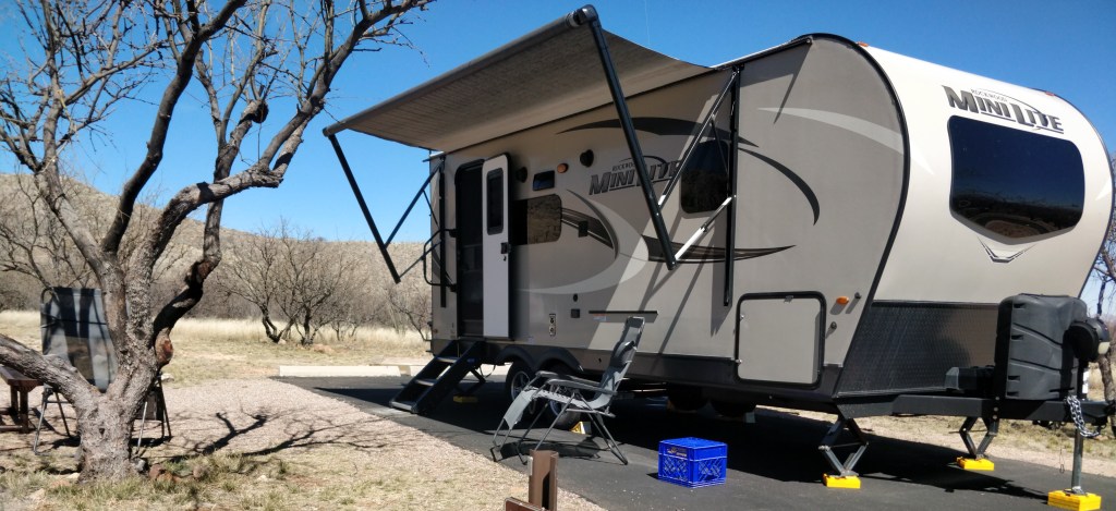
We camped at Kartchner Caverns State Park for four nights. Site #29 was a spacious back-in spot with picnic table, fire ring and water/electric hook up. Dump station is located near park exit. The asphalt site required one leveling block. Hookups were easily accessed and functioning properly. Restroom/shower buildings were large and cleaned daily. Roads throughout the park were well maintained. Several hiking trails were easily accessed from the campground. A large visitor center was a short distance away for cave tours, gift shop, and exhibits. The park, cabins, and facilities were in beautiful condition and provided us with a great experience. Located between Benson and Tombstone, we would highly recommend this state park campground.
Thank you for visiting TheirRVtravels! We hope the new photo format was worth the delay in posting for you! As always, we are so grateful to have you along for the ride!
If you’d like to know when a new post is ready, please subscribe below. We will never sell or share your information.


Next up…Monasteries and Mountains
